Sunday, 23 June 2013

Tintagel to Harlyn Bay: June 2013


June 2013

A week's walking from Tintagel to Harlyn Bay with a mixture of circular and linear walks.  We used a combination of bus and/or car to get to the beginning and end of the walks.

Accommodation for the week was at Delamere Holiday Bungalows, Delabole.  The bungalow provided good value, simple accommodation, ideal for our purposes with the bonus of wide open inland views.

Delamere Holiday Bungalows, Delabole
 

Tintagel Church to Trebarwith Strand
(3km/2 miles)
Saturday 08 June 2013

Arriving at Tintagel we enjoyed a picnic lunch at the National Trust car park at Tintagel Church, with views out to sea.  We had originally planned to visit the castle, but decided to take advantage of the beautiful, hot, sunny day, and do a circular walk on the stretch to Trebarwith Strand, instead.  This is a section with spectacular coastal views and interesting abandoned quarries, some with fantastic rock-hewn formations.
 
Trebarwith Strand
Trebarwith Strand, with Gull Rock about half a mile offshore, has a cafe and pub.  We enjoyed an excellent pot of Assam 'tea for two' (£2.00) at The Strand Cafe before returning to the car along 'inland' paths and tracks through the village of Treknow and the tiny settlement of Tregatta.
 
Walk total approximately 5.9 km/3.5 miles; South West Coast Path cumulative total: 238 km/148 miles.
 

Trebarwith Strand to Crookmoyle Point (Approximately 5.9 km/3.5 miles)
Sunday 09 June 2013

Another glorious, hot sunny day!
 
A circular walk, parking the car at Trebarwith before crossing the fields to Trebarwith Strand.  Once again we enjoyed the hospitality of The Strand Cafe for a coffee before embarking on the walk 'proper'.
 
The Strand Cafe, Trebarwith Strand
 
This is a strenuous - even severe - section with high cliffs cut by a series of valleys: some of them precipitously steep-sided.  From Trebarwith Strand the Path climbs steeply up above Dennis Point and then, almost immediately down to Backways Cove and then up, again, to Treligga Cliff.  The Path continues towards Tregardock Beach, a delightful, isolated beach with a glorious expanse of golden sands and then on to Jacket's Point with its steep-sided valley.
 
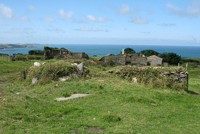
Our route left the South West Coast Path at the footpath that leads to the ruins of Dannonchapel (NT).  According to Wikipedia, Dannonchapel was mentioned in the Domesday Book (1086) and was occupied by one villein and four serfs.
 
File:St Teath, Dannonchapel - geograph.org.uk - 934329.jpg
Dannonchapel (Courtesy: Wikipedia)
Our route back to Trebarwith took us past the modern Tregragon Farm and the lane to Treligga.  We were expecting a quiet country lane, but, instead there was a constant flow of traffic in both directions.  At Treligga we discovered the reason for this: one of the gardens was open as part of the National Gardens Scheme (see the Cornish Guardian article).
 
The footpath had been re-routed to avoid going through the Trecarne farmyard and we missed the way, trying to follow the old signs, which were still in place.  All rather confusing!  The young farmer's wife, however, pleasantly set us on the right path - across a field with a huge bull in it with his many wives.  We were assured that he was just a big 'softy' and really quite harmless.  Nevertheless, we did not dawdle across the field!
 
Walk total approximately 13.6km/8.5 miles; South West Coast Path cumulative total: 244km/151 miles.
 

Crookmoyle Point to Port Isaac Harbour
(Approximately 5.5km/3.5 miles)
Monday 10 June 2013

 
We returned to the Coast Path near Crookmoyle Point, passing once again the ruins of Dannonchapel.  The route, again, is a wonderful, craggy section with a good number of steep-sided valleys and inlets.
 
After the quiet and relative loneliness of the cliff-top path away from habitation, Port Isaac seemed to us to be a very busy honey-pot of a place!  To add to the excitement, filming of the television series 'Doc Martin' was taking place while we were there.
 
Port Isaac
 
After a picnic lunch sitting on a harbour wall, we caught the bus from the Pea Pod bus stop back to Delabole.  The driver kindly dropped us off at the lane to Delamere Holiday Bungalows.
 
Walk total approximately 11 km/7 miles; South West Coast Path cumulative total: 250 km/155 miles.


Port Isaac Harbour to Lundy Hole
(Approximately 6.5 km/4 miles)
Tuesday 11 June 2013

 
Drove to a small pull-in near to the Bee Centre and then caught the little green Western Greyhound bus from Porteath, Port Quin Cross to Port Isaac for the beginning of the walk.  Before doing so, though, we stopped for a coffee at the Old School Hotel and Restaurant.
 
This is described as 'a rollercoaster of a path, closely following the ups and downs and ins and outs of the quiet, scenic but energy-sapping coast' (South West Coast Path Association).  That was our experience!
 
A high-point was seal-watching at Downgate Cove.  Along the trail were wild flowers in abundance: bladder campion, red campion, valerian in pink, white and red, kidney vetch, wild roses, fox gloves, oxe-eye daisies, bittersweet and thrift, to mention just a few.
 
 
Our route from the little bay below Lundy Hole was across the fields to the farm at Porteath and the lane past the Bee Centre and back to the car.
 
Walk total approximately 9.6 km/6 miles; South West Coast Path cumulative total: 256 km/159 miles.


Lundy Hole to Polzeath Beach
(Approximately 7.5 km/4.5 miles)
Wednesday 12 June 2013

One of those wet days that you don't want when you plan a walk!  For this reason we started our day's walk rather late, having spent the morning in the bungalow watching the clouds and the rain.
 
We drove to the Lundy Hole National Trust car park and started our walk at about 4pm - for an early evening circular walk to Polzeath.  At first we followed the footpath from opposite the car park and headed down to the little bay just below Lundy Hole before following the Coast Path proper up to the Hole: a collapsed sea cave.
 
Lundy Hole
The Path took us past The Rumps and on to turn the corner at Pentire Point, heading then in a south-easterly direction along the Camel estuary towards Polzeath Beach with its surfers.  We paused for a picnic tea at Pentireglaze, having got rather wet wading through the long wet grass combined with the rain showers.  In addition to that, the very strong wind was a constant challenge, nearly blowing me off my feet at Pentire Point!
 
Walk total approximately 11 km/7 miles; South West Coast Path cumulative total: 263 km/163 miles.

Polzeath Beach to Rock (Ferry)
(Approximately 4 km/2.5 miles)
Thursday 13 June 2013

Another late(ish) start to catch the Western Greyhound bus, 12:17 from the Clock Garage in Rock to Polzeath Beach (£2.20).  We had parked the car in the layby in the lane opposite the Spar stores.
 
Arriving at Polzeath it was time for coffee so we stopped at The Galleon Beach Cafe (check it out on Tripadvisor..... we didn't!).  Coffee was OK: an Americano and Café Latte at £4.88 was plenty, though.
 
From Polzeath the Path heads in a southerly direction to Trebetherick Point, with Daymer Bay and Brae Hill coming into view.
 
We intended to head straight for St Enodoc Church, but my navigation skills let me down and we missed the direct footpath from Daymer Bay across the golf links to the church.  Instead we followed the path that skirts the eastern side of the hill and approached the church from the south.
 
St Enodoc Church from Brae Hill
After sitting on a seat in the churchyard for a picnic and visiting the church we returned to Daymer Bay and continued to Rock on the Coast Path - this side on the seaward side of Brae Hill.
 
The Rock to Padstow Ferry
From the ferry we returned up the road to Rock, stocking up with provisions at the Spar store on the way.
 
The afternoon was bright and sunny with a fair fresh breeze: very good for walking.
 
After returning to the bungalow, we decided that a meal out would be a good idea and had a steak dinner at The Mill House, Trebarwith.  The two steaks with all the trimmings at £20.00, we thought represented good value.  We thought the complimentary soda bread rolls tasted a bit odd, though.  We would have preferred ordinary bread or rolls!
 
Walk total approximately 9.6 km/6 miles; South West Coast Path cumulative total: 268 km/166 miles.


Padstow to Harlyn Bay
(Approximately 11 km/7 miles)
Friday 14 June 2013

Padstow Harbour
Another bad weather forecast for today!  We decided to 'go for it', however, and were rewarded by having a good walk - with, in the event, very little rain.  At one point, though, when we were near to Stepper Point, it did start to rain - and was threatening heavy rain, so we donned our watherproofs.  Almost immediately, though, the rain stopped!
 
The Camel Estuary from north of Padstow
We drove to the Harlyn Bay car park (£4.00 for the day) and then caught the 11:13 Western Greyhound 556 bus to Padstow.  We set out from Padsow on this easy, gentle section, arriving at Hawker's Cove at about 1pm - just in time for a bowl of very good home made leek and potato soup and a pot of tea (£10.20) at the unique Rest a While Tea Garden.  Things were getting busy in the tiny back garden of the terraced house and we shared the picnic table with a couple from St Helens and two women - also from Merseyside - exchanging stories of our travel experiences.  Food and drinks are all served from the back kitchen through the window - and there is no inside seating.

After spending a leisurely hour at Rest a While we set out again, stopping for a little more lunch at Trevone Bay.  We reached Harlyn Bay just as it started to rain and were glad to have a flask of tea in the car, watching the rain.

Walk total approximately 12.3 km/7.5 miles; South West Coast Path cumulative total: 279 km/173 miles.

Details of the South West Coast Path may be obtained from The South West Coast Path Association. The Association annually publishes a comprehensive guide, which is free for members.

For maps I like to use the Ordnance Survey 1:25,000 Explorer series and I find it very handy to print off relevant sections on A4 sheets. This saves having to carry large maps, which have to be unfolded and re-folded repeatedly! OS offer a good value subscription to GetaMap which enables one to do this - and much more.

For some sections of the Path we are 'back-packing', used a combination of bed and breakfast accommodation and Youth Hostels. For other sections we often use a combination of the car and buses to get to the beginning and from the end of the day's walk. Sometimes, where the bus services are very limited, careful planning is needed! The Traveline website is a valuable tool for this, with maps of bus routes, the location of bus stops and timetables.
 

Monday, 27 May 2013

Bude to Tintagel: May 2013


May 2013


We covered the twenty miles or so of this section of the Coast Path in four sections and stayed at the excellent Boscastle Youth Hostel while we did so.  The hostel is right on the harbour and we would thoroughly recommend it as a place to stay.  Our walking varied from about 4 miles on the first day, to a maximum of about 8 miles on subsequent days.
 
Boscastle Youth Hostel (Courtesy YHA Website)

Monday 20 May 2013
Bude to Widemouth Bay (4 miles)

The South West Coast Path Association's handbook describes the section between Bude and Crackington Haven as 'easy then strenuous'.  We did the 'easy' part - from Bude to Widemouth Bay - on our first day's walk, aiming to reach Tintagel by the end of the fourth day.
 
We headed out from home for Widemouth Bay and parked the car in the small car park about 250 yards north of Widemouth Manor Hotel (SS198014) to catch the bus to Bude for the start of the walk.
 
Arriving at Bude we decided that, before setting out we should have a coffee and called at the Castle Tea Rooms.  When I asked for an Americano with some cold milk I was curtly told that it would be an extra 10 pence for the milk.  It was a good coffee - and still good value at £1.70 (including the milk!).
 
Refreshed by our coffees we set out on our way to Widemouth Bay, crossing the Bude Canal at the restored sea lock. 


File:Bude haven.JPG
Bude Canal Sea Lock (from Wikipedia)
 
Leaving Bude; entrance to the Sea Lock in the middle distance
The walk was an easy four miles or so, passing by Compass Point with its squat tower and gently climbing Efford Beacon.
 
Widemouth Bay was a hive of activity with children from the nearby Outdoor Adventure centre enjoying tuition in surfing and abseiling.  We were not too sure that one young lady (about 11 years old) was actually enjoying things too much, though.  It appeared that she was being very patiently encouraged to abseil down the low cliff onto the beach at Black Rock, but she apparently decided that abseiling was not for her - not on that occasion, anyway!


Spring flowers were in abundance; bluebells, primroses, sea campion, red campion, gorse and wild roses to mention but a few.
 
A few yards from Widemouth Manor Hotel we left the Coast Path and returned to the car then drove the six or seven miles to Boscastle to receive a warm welcome from Linda at Boscastle Youth Hostel.
 

Tuesday 21 May 2013
Widemouth Bay to Crackington Haven
(6 miles)

Taking advantage of the regular bus service between Crackington Haven and Widemouth Bay, we set out by car to Crackington Haven to park the car in the main car park (£5.00 for the day) and catch the bus from there to the Widemouth Manor Hotel bus stop.
 
As we were early for the bus and had time for some refreshment, we made for the Cabin Café for a coffee.  This time the milk was complimentary with the Americano!
 
Arriving at Widemouth Bay, we rejoined the Path where we had left it the previous day.
 
The South West Coast Path Association Handbook describes this section as 'strenuous'; that was our experience of it!  It crosses a number of deep valleys (I failed to count them!), but were rewarded with stunning views.
 
Where there's a down, there's an up!
On the way down from Chipman Cliff to our sheltered lunch spot down at the bottom...
 
 
Although it was late May, there was a distinctly cool spell of weather, with a cold northerly wind.  It seemed as if all the seats were placed in the most windswept spots: too cold for us to stop and eat our picnic!  In the end, we found a little shelter on a grassy bank beside the Path at the bottom of one of the deep-sided valleys.  Grey clouds persisted all day, but, at least, the rain held off.
 
The cumulative distance so far, approximately 217 km/135 miles.
 

Wednesday 22 May 2013
Crackington Haven to Boscastle (7 miles)

 
This morning we set out from Boscastle for Crackington Haven by bus, arriving at Crackington Haven in time for coffee, once again, at the Cabin Café before setting out on another 'strenuous' section.
 
The day was brighter, but the cold northerly wind persisted, so, come lunchtime, we found a clump of grass to act as a cushion in the deep valley below High Cliff, the highest cliff in Cornwall.
 
From our sheltered lunch spot our path climbed once again, passing Rusey Cliff towards Fire Beacon Point and the inlet of Pentargon before descending to Boscastle.
 
The outer harbour, Boscastle
Having returned to Boscastle, we made a short detour along the delightful 'Panorama Walk', which runs from above the harbour close by the Youth Hostel to Penally House on the B3263 above the village.
 
Our day's walking total was about 12.6 km/8 miles, with a cumulative distance of approximately 228km/141 miles.
 

Thursday 23 May 2013
Boscastle to Tintagel Church (5 miles)

It was with a little sadness that we left Boscastle Youth Hostel for the last walk on this leg of the South West Coast Path: heading for Tintagel.  We'd had a lovely time at the hostel and been made exceptionally welcome by the staff.  If we have an excuse, we'll be back!
 
After parking the car in a small lay-by a few minutes walk from the centre of the village, we set out for Tintagel.  It was another bright but cold day - and we were glad of layers for warmth and protection from the cold northerly wind.
 
The Path for this stretch is described as 'moderate'.  There are all the best ingredients of the best ingredients of the Path: stupendous views, steep valleys and short rocky scrambles, making this a worthwhile walk.
 
Looking north from Willapark, Bossiney with Cambeak in the distance
When we reached entrance to Tintagel Castle at Tintagel Haven, instead of going into the castle, we followed the Coast Path behind the Castle and had a brief lunch stop, sheltering from the wind as best we could.  From there we carried on the few yards to the church before walking down the lane to the village to catch the bus back to Boscastle from opposite the Visitor Centre.
 
The day's walk total was approximately 11.2 km/7 miles, with a cumulative total of 235 km/146 miles.
 
Another very successful end enjoyable trip: not without its challenge, but all very good!


Saturday, 20 April 2013

Hartland Point to Bude: April 2013


April 2013

 
We decided to complete the part of the South West Coast Path from Hartland Point to Bude over three days: back-packing, walking about seven miles each day.
 

Monday 15 April

The journey to the start of the walk was by car to Stratton, near Bude, where we parked the car close by the church for the three days of our walk.  We then caught the bus to Hartland and walked the three miles to West Titchberry Farm along quiet country lanes. We received a warm welcome from Mrs Heard, who cooked a very tasty evening meal of beef casserole with vegetables followed by apple and blackberry crumble.  We then enjoyed coffee in the sitting room with a log fire, watching television, before retiring to bed in the huge en-suite bedroom.
 
West Titchberry Farm
 

Tuesday 16 April:
From West Titchberry Farm to Elmscott Youth Hostel

Today was the beginning of the proper walk!  We began the day with a hearty 'full English' Farmhouse breakfast and then Mrs Heard bid us farewell with an excellent - and very good value - packed lunch.
 
We commenced our walk by heading towards Smoothlands (SS230266), where we had finished the previous section in March 2013.  From there we followed the 'ups' and 'downs' (a hall-mark of this section - almost all the way to Bude) as far as Hartland Quay, where we called at the Hartland Quay Hotel for a light lunch: Elizabeth had soup and I had an 'Award-winning Devon Pasty'!  We were glad to be able to escape indoors to from the biting, cold wind.


Looking south from Hartland Quay


A cold day at Hartland Quay


After lunch we set out for Elmscott Bunkhouse Youth Hostel.  When reached the signpost to the hostel we decided that, as we were ahead of scedule, we would continue to Dixon's Well and Sandhole Cross (SS224211); turning left to reach the hostel by the lane.
 
As we were the only guests at the hostel, we were able to choose which room we could use - so we chose the comfort of the largest (six-bed) room in the old schoolhouse.  We bought provisions from the hostel store to make an evening meal and breakfast in the morning.

'That way .... but not yet!'


We have a soft spot for Elmscott Youth Hostel.  Way back in the late 1980s we acted as voluntary wardens for two weeks in two consecutive years, so it was a little like returning home!


Elmscott Bunkhouse

Wednesday 17 April 2013
Elmscott to Morwenstow

We started out from the Youth Hostel on route to Morwenstow just before 10am, rejoining the Coast Path at Dixon's Wells (SS224211).  The whole coastline is spectacular with steep, deep valleys to be negotiated - frequently.
 
Ronald Duncan's Hut
 
We stopped for lunch in Ronald Duncan's Hut - again glad of being able to escape from the strong wind for a few minutes.  Ronald Duncan (1914 to 1982) is described in Wikepedia as a 'writer, poet and playwright' and the hut was built to in his memory to replace the one in which he used to write, which stood in the same place, but became delapidated over the years.
 
With thanks to Robert: 'The Solitary Walker' (see his Blogs)

Shortly after leaving Ronald Duncan's Hut, we crossed the footbridge at Welcombe Mouth, leaving North Devon behind: entering Cornwall before heading on to Morwenstow.


Welcombe Mouth


We somehow missed Hawker's Hut on the cliffs at Morwenstow.  We were later told that sign was not very clear!  Instead we continued on the Path and descended to Tibna Shute before following the delightful wooded valley with its carpet of wild flowers: daffodils, primroses and violets to Trelawney Bed and Breakfast, Crosstown, Morwenstow.
 
After eventually finding Trelawney (we asked for directions at The Bush Inn) and booking in, we returned to the inn for an excellent dinner.  We enjoyed the company there of a couple who were also walking the Coast Path.  
 
Trelawney Bed and Breakfast, Crosstown, Morwenstow

Thursday 18 April 2013
Morwenstow to Bude

Mrs White of Trelawney Bed and Breakfast served an excellent and tasty breakfast before we returned to the Coast Path, retracing our steps through Tibna Shute.  The first part of the Path was more strenuous than the latter, with one very steep climb from Stanbury Mouth.


Inquisitive cattle and the Radio Station above Duckpool

We eventually made it to Sandy Mouth, where there was a café.  We were glad to have somewhere to sit and enjoyed a jacket potato and a pot of tea for a late lunch, buying some eccles cakes for pudding - for later.
 
 
Sandymouth Café
The rest of the way to Bude was relatively 'easy': at least after all the 'ups' and 'downs' of the last couple of days!  We made our way to The Strand bus stop (where we ate our eccles cakes!) and caught the bus to Stratton to puck up the car for the journey home.
 
On the way home we stopped off at The Puffing Billy at Exton for an excellent dinner to round off this thoroughly enjoyable part of our South West Coast Path expedition.


Details of the South West Coast Path may be obtained from The South West Coast Path Association. The Association annually publishes a comprehensive guide, which is free for members.

For maps I like to use the Ordnance Survey 1:25,000 Explorer series and I find it very handy to print off relevant sections on A4 sheets. This saves having to carry large maps, which have to be unfolded and re-folded repeatedly! OS offer a good value subscription to GetaMap which enables one to print off sections of maps (both of the 1:50,000 Landranger and 1:25,000 Explorer series).

Up-to-date information to assist with planning walks using local bus services may be found on the Traveline website.

Sunday, 17 March 2013

Barnstaple to Hartland Point: March 2013

March 2013


Details of the South West Coast Path may be obtained from The South West Coast Path Association. The Association annually publishes a comprehensive guide, which is free for members. 

For maps I like to use the Ordnance Survey 1:25,000 Explorer series and I find it very handy to print off relevant sections on A4 sheets.  This saves having to carry large maps, which have to be unfolded and re-folded repeatedly!  OS offer a good value subscription to GetaMap which enables one to print off sections of maps (both of the 1:50,000 Landranger and 1:25,000 Explorer series).

Up-to-date information to assist with planning walks using local bus services may be found on the Traveline website.


We walked the part of the Path from Barnstaple to Hartland Point while staying at The Beachside Holiday Park, Westward Ho!  The mobile home on the park provided us with comfortable self-catering accommodation, a few minutes' walk from the village and bus stops. 
 
Staying at Westward Ho! enabled us to use the excellent local bus services to provide links for our walks.


Saturday 09 March 2013:
Barnstaple to Instow

We drove to Westward Ho! on Friday 08 March and settled ourselves into our home for the week, ready for an early start for our first day of walking.
 
We caught the 09:07 bus for Barnstaple from opposite the car park, enjoying the views on the hour's journey from the front of the top deck.  Alighting from the bus on Braunton Road, we followed the Path from where we had left it - just beneath the new Taw Bridge (SS550333) - through Barnstaple to the Tourist Information Centre, situated at The Museum of Barnstaple and North Devon in The Square.  The Path then led us across the 'old' Long Bridge before joining the Tarka Trail.


For much of the way to Instow, the route follows the former railway line beside the Taw estuary.  This provides, for the most part, easy, level walking, much of it surfaced.  We were glad when we arrived at the old Fremington Quay Station for a brief pause for refreshment.  We started, sitting at one of the tables outdoors on the old platform, enjoying a delicious celeriac and thyme soup, when with little warning there was a sudden heavy shower.  We, together with the other customers on the platform/terrace quickly retreated indoors!

 
Fremington Quay Station Café
The shower didn't last long and we set out once again, following the Path around the marshes of East Yelland and Instow Barton, passing by the site of the old power station before reaching Instow.
 
We caught the bus from Instow back to Westward Ho!
 

Appeldore from Instow


Sunday 10 March 2013:
Instow to Westward Ho!


Appledore from Instow
Once again we caught the bus to the beginning of our walk at Instow.  The South West Coast Path continues to follow the old railway line and Tarka Trail as far as Bideford., where we took a short break for coffee at the old railway station in Bideford: the café is in an old railway carriage: the plate on it said that it was built in 1958!
 
After our coffee break it started raining - but we carried on regardless, leaving the Tarka Trail and crossing to the main part Bideford on the old Long Bridge, before turning north along the quay.
 
We had originally intended to leave the Coast Path near to Hyde Barton and catch a bus back to Westward Ho! from Northam Square.  Despite the showers, though, we decided to carry on - and completed the distance back to Westward Ho! on foot.  By doing this we 'gained' a day on our original itinerary: we were very pleased with ourselves!  It, perhaps, should be pointed out that the going on this section was 'easy' with very little in the way of ascents and descents.  The handbook tells me that the total ascent is 160 metres (528 ft).

En-route we paused for a picnic lunch in the bus shelter (sheltering from the rain) at Appledore and then, spying the Johns of Appledore café we decided that we needed to go inside for a warm-up and some (more) refreshment!  We had a pot of tea for two and Elizabeth had the last portion of excellent home-made soup, while I found room for a pasty.

When we had finished the second stage of our lunch break, we set off for Westward Ho!, passing through the picturesque narrow streets of Appledore and then around the rather exposed Northam Burrows Country Park.

The day's walk was approximately 19.9km (12 miles).
 

Monday 11 March 2013:
Westward Ho! to Worthygate Wood

The South West Coast Path Association's Guide suggests that the day walk from Westward Ho! might be to Clovelly: an 11 mile 6 hour 'strenuous' hike.  With that in view, we decided to split the stretch at Worthygate Wood (SS366237).
 
Looking north towards Westward Ho! from Peppercombe
 
There are certainly plenty of 'ups' and 'downs' to warrant this stretch the title of strenuous!  One is rewarded, though, by spectacular coastal views.
 
We broke our day's walk for a short picnic lunch break on the beach below Portledge before continuing on to Peppercombe Castle and Worthygate Wood, where we left the Coast Path at Gauter Pool to head inland to Higher and Lower Worthygate with a view to catch the bus back to Bideford with a connection there to Westward Ho!  As things worked out we were rather early for the bus - and there was no clear bus stop or shelter, so we walked down the main A39 road to The Hoops Inn, where we warmly welcomed and sat down for a coffee beside a roaring log fire.  That was after we had made sure that the bus would stop there!
 
The day's walk total was approximately 12.3km (7.5 miles).
 
Heading throught the woodland up to Peppercombe Castle we spotted some curious bright red 'cup-shaped' fungus.  We think that these were Scarlet Elf Cup (Sarcoscyph Coccinea).  Although allegedly edible (and we did not feel tempted to try!), they are not regarded as worth bothering with.
 
Scarlet Elf Cup (Courtesy of Guardian.co.uk)
We were very pleased with this 'find' as fungus tends to be rather scarce in the winter months!


Tuesday 12 March 2013:
Worthygate Wood to Clovelly

We drove from Westward Ho! to the layby just to the east of Lower Waytown (SS366237), parking the car there.  From the layby we retraced our steps to Coast Path near Gauter Pool in Worthygate Wood.


Follwing the Path west, we soon were steeply descending down to Buck's Mills.  What goes down must go up!  The path winding up through Keivill's Wood is rather steep: a long, steep climb!  The bench at the top was very welcome!
 
The rest of the day's walk was relatively easy following woodland and field paths before reaching The Hobby Drive for the final stretch to Clovelly.  The Hobby Drive was the old carriage road to Clovelly, emerging a few metres from the Clovelly Visitor Centre, with its café, shops, car parks and bus stop on the Bude and Hartland to Bideford and Barnstaple bus route.  Be warned, this is an infrequent service so if you intend to do a bus walk, careful planning may be necessary.
 
Total distance walked was approximately 9km (5½ miles).

For the return journey to the car we caught the bus from the Visitor Centre and then drove back to Westward Ho!  An alternative plan might be to park at the Visitor Centre (enquire about possible concessionary rates for Coast Path walkers) and take the bus to the beginning of your walk.


Wednesday 13 March:
Clovelly to Fatacott Cliff

View from above Clovelly
Another bus walk!  This time we drove to Hartland and parked in the Square car park (free) in time to catch the bus to Clovelly Visitor Centre.  The route (described in the SWCPA Guide and 'moderate to strenuous') has its fair share of steep 'ups' and downs'.  We paused for a picnic lunch after one of these climbs.
 
At Fatacott Cliff (SS264274) we turned away from the Coast Path on the sign-posted permissive path to return to Hartland down the lane (here we were caught in a sudden, sharp, hail storm) to West Fattacott Farm (the spelling on the map is different for the cliff and the farm!), then following the lanes back to the village, stopping for a flask of tea by a stile above Pattard Bridge, where a footpath crosses the steep meadow (SS262252) before returning to the car.
 

Thursday 14 March:
Fatacott Cliff to Hartland Point and
Upright Cliff

Hartland Lighthouse and Lundy Island
We had 'gained' a day on Sunday, so we took advantage of the additional day by doing a circular walk so that we could round Hartland Point, rightly described as one of the great defining headlands of the Coast Path and finishing this stretch above the small valley (un-named on my maps) between Upright Cliff and Smoothlands (SS230266). 
 
We parked the car in the (free) National Trust car park at East Titchberry (SS244270).  From there we followed the footpath to the Coast Path  and then headed east.  For the first 400 metres we followed the Coast Path and then where the Coast Path bears left, we followed the field path more or less straight ahead, roughly parallel to the cliffs; about 200 meters inland. 
 
At the permissive path near to Fatacott Cliff (SS264272), we turned left to rejoin the Coast Path, heading west towards Hartland Point with the rather curious 'mushroom-shaped' radar tower as a landmark
 
Close by Hartland Point there is a car park (charges may apply) and seasonal refreshments.
 
After 'turning the point' we headed south and crossed the small valley, climbed the steps, and headed inland along the rough footpath on the south side of the valley.  At the end of the path we turned left at the lane, crossed the footbridge and returned to the car park via Blagdon Farm and then along the lanes.