Tuesday, 22 October 2013

Hell's Mouth, Gwithian to Morvah: September 2013

The original aim was to walk the distance to St Just.  Events happened to prevent this, but more of that in due course!
 
Our base for this section was The Treloyhan Manor Hotel in St Ives, a Christian Guild Hotel.  The hotel provided comfortable, good value half board accommodation: excellent buffet breakfasts each morning and good evening meals.
 
St Ives
Gwithian, Hell's Mouth to Hayle

We started this section on Sunday 15 September 2013 by catching the Western Greyhound service 547 bus from the Cornish Arms bus stop, near to the Treloyhan Manor Hotel to the Hell's Mouth Cafe, Gwithian.  After coffee at the cafe, we set out on the way to Hayle, pausing to watch the 15 or so seals way below us on the beach at Fisherman's Cove - too far below us to make a worthwhile photograph.
 
The path then took us around Navax Point and Godrevy Point with the lighthouse on Godrevy Island.
 
At Godrevy Point
Weather had started fine, but as we rounded Godrevy Point and headed towards Hayle the heavens opened!  The rest of the way that day, as we negotiated our way across the dunes to Hayle, was a wet way.
 
When we finally arrived at Hayle we were glad to catch the Western Greyhound bus back to the Cornish Arms bus stop with a welcome bath back at the hotel.  The day's walk was an easy eight miles with little in the way of ascent or descent.

Hayle to St Ives

The next stage was from Hayle to St Ives, which we did on a rather wet day.

We caught the bus from St Ives to Hayle to walk the return journey.  We bought sandwiches for lunch and paused for a coffee before setting out - and then, dodging a rain shower, ducked into the Hayle Heritage Centre.

The Centre provides a fascinating insight to the history of the area and of the importance of the town in the earlier days of the Industrial Revolution.

From the Heritage Centre, The Coast Path passes underneath Brunel's railway Viaduct and then across The Causeway, along the northern side of the Hayle Estuary.

The Hayle Estuary is described by the RSPB on their web site as one of the best places for wildlife in the UK.  Among the birds which we spotted on the estuary were swans, little egrets, oystercatcher, teal and greenshank.

On the way back to St Ives we visited St Uny Church, Lelant, overlooking The Towans on the opposite side of the estuary and then followed alongside the railway to Carbis Bay, where we ate our sandwiches sitting on the bench at the top of the flight of steps near to Carbis Bay Station.

Before returning to the hotel we paused again for refreshments at the cafe on the beach at Carbis Bay: an easy walk of about 5.5 miles.

St Ives to Zennor

We had already walked the section from Treloyhan Manor Hotel into St Ives, around St Ives Head, alternatively called 'The Island', as far as the Tate St Ives Gallery, on the Saturday that we arrived in St Ives.  We thought that it would still 'count' if we did not repeat this section!

We started the day by a quick trip to the Tesco store for our picnic lunch for the day, before catching the bus the short distance from The Cornish Arms to the bus station in St Ives. 

We set out through the town: up hill and down again, passing the Back-packers hostel on the way, eventually reaching the coast path just below the cemetery.


The South West Coast Path Guide describes this section as 'severe': so we were expecting it to be tough: 'It is tough going, with rocky scrambles and boggy lengths.  But it can only be described as a magnificent length.'  We agree: certainly it has its challenges, but the stunning views more than compensate.  We were fortunate, too, that after a long dry period, we did not have to contend with very much in the way of boggy patches, despite the heavy showers on the way.
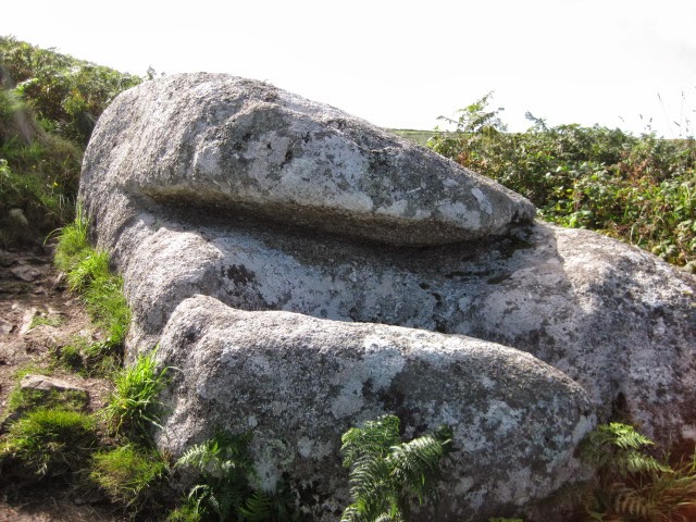
A rock to clamber over.....
At Zennor Head we headed for the hamlet of Zennor, with its pub, the Tinners Arms and Backpackers Hostel. 

We had plenty of time before the bus (a Western Greyhound bus service 508) to St Ives was due, so we paused for refreshment at the Inn.  When we arrived at the bus station we, once again, rather 'cheated' and caught the bus up the hill to the hotel.

The day's walk was about 7.5 miles, 6 of which were on the Coast Path.  Another thoroughly enjoyable, and - yes, challenging day.

Zennor to Morvah

It had been our intention to walk from Zennor to Pendeen, but events, referred to previously, put an end to this.

The day started absolutely fine: we returned to Tescos to buy our picnic lunch and then walked down to the bus station with plenty of time to catch the 09:35 Western Greyhound bus to Zennor, arriving there at just the right time to pause for a coffee at the Backpackers Hostel.

Refreshed, we set out on the way, heading the half mile or so back to the Coast Path, passing the church on the way.

Zennor Church
All was going very well, passing by Gurnard's Head and Porthmeor Point followed by Porthmeor Cove.  Once again the going was 'severe'.  But that didn't daunt us!

It was fascinating and awe-inspiring to watch the gannets doing their aerobatics and diving for fish along this coastline.

Gurnard's Head
We were doing well - with Pendeen Watch well within our sights for the day's walk.  Then it all came to an end!  Near Carn Veslan Cliff, a short distance after Porthmeor Cove, Vaughan, as usual stepping out ahead, stepped on what he thought was firm ground, which proved to be nothing more an a soft clump of grass.  Over he went!  And with a suddenly very painful ankle!

The Path - not where he fell, though!


We carried gingerly on for a bit, until Vaughan decided, just by Morvah that he did not want to go on any further.  We finally made it, with Vaughan hobbling on the uneven path to the shelter of the church.  There we waited the hour for the bus back to St Ives.

That was all the walking for this trip; we returned home early, Vaughan resting his sore ankle!

The total day's walk was approximately 7 miles (South West Coast Path distance approximately 5 miles).  The cumulative distance from Minehead was approximately 243 miles.

Saturday, 17 August 2013

Perranporth to Gwithian, Hell's Mouth: August 2013

The Perranporth Sundial
This seventeen mile stretch was covered in one full day walk and two short(ish) half-day linear walks.  Our accommodation for the two nights was at the superb Portreath YHA Bunkhouse, where we treated ourselves to the luxury of a large three-bedded en-suite room.
 

Portreath YHA Bunkhouse

The designation of 'bunkhouse' does not really do justice to the facilities on offer: comfortable rooms (all en-suite), some with double beds, a games-room with television and kitchen. Portreath is nothing like the 'basic' hostel that might be suggested by it's title!

Perranporth to St Agnes
Monday 05 August 2013

The first part of the walk was from Perranporth to St Agnes: about 4 miles of the Coast Path.  We drove from home to St Agnes: some of the way through a horrendous rain storm which caused localised flooding.

From St Agnes we caught the Western Greyhound 547 bus to Perranporth for the start of the next leg of the walk.

The Path climbs up past the Youth Hostel and round Cligga Head, passing a great deal of evidence of mining activity of years gone by, with spoil heaps and capped mine shafts.

Evidence of old mine workings near Cligga Head

The Path drops down to Trevellas Porth, then over Blue Hills before descending to Trevaunance Cove, where there are all facilities.

Trevaunance Cove
Instead of walking up the road to St Agnes, we followed the lane opposite the Driftwood Spars Pub, left around the bend to the footpath where the road takes a right turn (SW720513).  This footpath leads past the ruins of an engine house to the residential Trevaunance Road which leads down to the centre St Agnes, by the church.

Despite the heavy rain earlier in the day, we only had to endure one - rather heavy - shower.  It was one of those occasions when the wet-weather gear was essential!

Flora and fauna noted along the way: ravens and kestrel; heather and gorse.


St Agnes to Portreath
Tuesday 06 August 2013

It had been our intention to walk from the hostel to the bus stop at Bridge, but we left it a bit late, so, instead, we drove the mile or so and parked the car in the layby near to the bus stop and caught the Western Greyhound 547 bus to St Agnes Church.

From there we retraced our steps up Trevaunance Road to the footpath down to Trevaunance Cove.  Before setting out on the Coast Path, though, we decided that a coffee at the Driftwood Spars Pub was in order to set us up for the day.

Trevaunance Cove
The waymarked path follows a metalled lane before taking a footpath forking off to the right.  Shortly there is a steep climb to the cliff top, where the high-level path rounds St Agnes Head with yet more evidence of mining.


Climbing out of Trevaunance Cove: heather beside the path
Within a short distance the path passes by the iconic engine house at Towanroath before descending to Chapel Porth; then up - and down again - to Porthtowan.


Engine House at Towanroath
Chapel Port

Porthtowan
For much of the rest of the way to Portreath the path follows alongside a fence next to Ministry of Defence land, passing yet more mine workings.

Portreath is a former industrial harbour town, with all facilities.  This is not, though, a picturesque Cornish harbour! The harbour-side is an area of modern housing that could be found anywhere in the country.

Portreath
We paused for liquid refreshment at the Portreath Arms while waiting for the bus to Bridge before the short drive back to the bunkhouse.

Flora and fauna noted along the way included razorbills, a juvenile kestrel and a peregrine falcon.  Heather and gorse in abundance on the cliff-tops.

The South West Coast Path distance walked had been just short of nine miles.

Portreath to Hell's Mouth
Wednesday 07 August 2013
 
Portreath
 
Another linear walk.  This time we drove to the layby near the Hell's Mouth Cafe in time for a cup of coffee in the cafe before catching the Western Greyhound 547 bus to Portreath for the walk back to Hell's Mouth and the drive home.

Above Hell's Mouth

Butterflies were in abundance including  red admirals, peacocks and tortoiseshells.  Also spotted a pair of linnets and a seal - but no porpoises!

The day's walk, was approximately 5 miles.  That means that the cumulative distance from Minehead is about 219 miles; if we add the East Devon and Dorset sections already walked, the total becomes 314 miles: just one short of half the total!

Saturday, 13 July 2013

Harlyn Bay to Perranporth: July 2013


Friday 05 July to Tuesday 09 July 2013

It was a beautiful, hot summer week-end.  Maybe just a bit too hot to be perfect for long-distance walking and it was tempting to join the other holidaymakers relaxing on the beaches.  The mile upon mile of stunning golden sandy beaches will be one of the lasting memories of this stretch of the Coast Path. 

Despite the heat we decided to walk as planned and fortunately, for most of the time, there was enough of a gentle coastal breeze to cool the air to make things bearable - even enjoyable!  We did make sure, though, that we used plenty of sun block and that we had lots of water with us!

Harlyn Bay to Treyarnon Bay

We had driven from home with the intention of doing a circular walk from Treyarnon Bay to Harlyn Bay via the Constantine Bay Golf Course, around Trevose Head and then back to Treyarnon Bay.

We arrived at Treyarnon Bay Youth Hostel about noon and wondered about whether to walk or just take things quietly.  After a bite of lunch we made our decision: head out for Harlyn Bay - despite the heat of the day - and were rewarded with some fantastic scenery and interesting geological features, among them the Round Hole on Trevose Head, a collapsed inland sea cave.

Harlyn Bay, complete with Kelly's Cornish Ice Cream van!

At Trevose Head
 

Harlyn Bay Youth Hostel.  Oops! with a house apparently on the roof!
Treyarnon Bay Youth Hostel proved to be an ideal place for us to commence this section: just a few yards from the beach with a large field for campers.  The hostel has a cafe and bar and meals are available both to hostelers and the general public.
 
There is plenty of car parking at the hostel, and there is a good bus service about a mile away at Constantine Bay, with buses to Padstow and Newquay.  This makes bus walks easy to arrange.

Treyarnon Bay to Whitesand Bay

Our next day's walk was from the Treyarnon Bay to Watergate Bay, pausing briefly at Porthcothan for drinks before setting out again along the Path with its awe-inspiring coastal scenery of Bedruthan Steps and the beaches of Mawgan Porth and Whitesand Bay.
 
Bedruthan Steps
 
At one point we watched a kestrel being 'seen off' - apparently successfully - by a solitary swallow.  Rather 'David and Goliath'!
 
Mawgan Porth
We had originally planned to walk only as far as Morgan Porth, but we decided to carry on the extra couple of miles or so to Whitesand Bay and catch the bus from there back to Constantine Bay instead.
 
Stopping on the way to catch our breath, admire the scenery, attempt to identify flowers and birds and chat to fellow hikers, we knew that we were getting too late to catch the 4:16pm Western Greyhound service 556 bus from Watergate Bay back to Constantine Bay.  We were in luck, though!  Just as we reached the bus stop, the bus turned up - almost fifteen minutes late.  We were very grateful for that late-running bus and didn't mind the rather bumpy ride back to Constantine Bay as the driver tried to catch up a bit of time.
 
The driver dropped us off at the Surf Shop and we then made our way down the lane to the beach car park before returning to the youth hostel along the Coast Path.  We had walked just over ten miles in the day; not bad, we thought, bearing in mind the unremitting heat.

Whitesand Bay to Newquay and The Gannel
 
The next day (Sunday) we took the car to Newquay and then caught the (service 556) bus to the start of our day's walk at Whitesand Bay.


Whitesand Bay

We set out from Watergate Bay at about 11:30am, the Path taking us to Porth and then on to Newquay.

In Newquay, failing to pay proper attention to the South West Coast Path handbook, we missed the way on the tramway path at the bridge, instead we continued on into the town, where we gave in to temptation and bought pasties for lunch from The Pasty Parlour in The Crescent.  We enjoyed our purchases sitting on a bench on the Killacourt, listening to live music from the stage across the way.

Newquay Harbour
Setting out after our lunch break we continued on the Path, passing the harbour, the Huer's Hut and Towan Head before reaching the National Surfing Centre at Fistral Beach.

Huer's Hut

Fistral Beach with Towan Head in the distance
Above the southern end of Fistral Beach we followed the 'alternative' route, heading in a westerly direction around Pentire and then following the Coast Path as far as the main A392 road before leaving it at the footpath (SW812608), winding its way through the housing of the Trenance part of Newquay and back to the car.

The Gannel to Perranporth

We started the day by checking out of Treyarnon Bay Youth Hostel and setting out for the National Trust Crantock Beach car park.  The parking attendant helpfully gave us precise instructions as to where would be a good place for us to park the car to avoid getting blocked in.

The Gannel
Initially we set out in the 'reverse' direction for a few yards towards the Gannel Ferry crossing to recommence the Coast Path walk from there.  As the tide was out, we returned to the car park along the beach before continuing on our way to Holywell Bay and Perranporth.

Holywell Bay and Gull Rocks off Penhale Point
Holywell Bay is a good stopping-off spot with its facilities (some of them seasonal).  There is also a regular bus service, making it convenient for bus walks.

After some discussion as to whether we might catch the bus from Holywell Bay back to Crantock and complete the section from there to Perranporth on the following day (Tuesday), we decided, nevertheless, to carry on - and to have Tuesday as a somewhat more leisurely day with it's drive home.  We completed the stretch to Perranporth with time enough for a coffee before catching the 6:20pm Western Greyhound Service 592 bus back to Crantock, with just a short walk to the National Trust car park.

We then drove back to Perranporth for the night in the youth hostel.

The Youth Hostel, Perranporth (Courtesy YHA)
Perranporth Youth Hostel is a small, simple hostel in a stunning position right on the Coast Path on top of the cliffs above Perranporth.

The distance we walked on the South West Coast Path for this trip was 51km (31.7 miles) giving a cumulative total from Minehead of 325km (202 miles).  The total distance walked on this trip (including getting to and from the ends of the walks) was approximately 59.8 km (37 miles).

This had been another lovely trip!


Sunday, 23 June 2013

Tintagel to Harlyn Bay: June 2013


June 2013

A week's walking from Tintagel to Harlyn Bay with a mixture of circular and linear walks.  We used a combination of bus and/or car to get to the beginning and end of the walks.

Accommodation for the week was at Delamere Holiday Bungalows, Delabole.  The bungalow provided good value, simple accommodation, ideal for our purposes with the bonus of wide open inland views.

Delamere Holiday Bungalows, Delabole
 

Tintagel Church to Trebarwith Strand
(3km/2 miles)
Saturday 08 June 2013

Arriving at Tintagel we enjoyed a picnic lunch at the National Trust car park at Tintagel Church, with views out to sea.  We had originally planned to visit the castle, but decided to take advantage of the beautiful, hot, sunny day, and do a circular walk on the stretch to Trebarwith Strand, instead.  This is a section with spectacular coastal views and interesting abandoned quarries, some with fantastic rock-hewn formations.
 
Trebarwith Strand
Trebarwith Strand, with Gull Rock about half a mile offshore, has a cafe and pub.  We enjoyed an excellent pot of Assam 'tea for two' (£2.00) at The Strand Cafe before returning to the car along 'inland' paths and tracks through the village of Treknow and the tiny settlement of Tregatta.
 
Walk total approximately 5.9 km/3.5 miles; South West Coast Path cumulative total: 238 km/148 miles.
 

Trebarwith Strand to Crookmoyle Point (Approximately 5.9 km/3.5 miles)
Sunday 09 June 2013

Another glorious, hot sunny day!
 
A circular walk, parking the car at Trebarwith before crossing the fields to Trebarwith Strand.  Once again we enjoyed the hospitality of The Strand Cafe for a coffee before embarking on the walk 'proper'.
 
The Strand Cafe, Trebarwith Strand
 
This is a strenuous - even severe - section with high cliffs cut by a series of valleys: some of them precipitously steep-sided.  From Trebarwith Strand the Path climbs steeply up above Dennis Point and then, almost immediately down to Backways Cove and then up, again, to Treligga Cliff.  The Path continues towards Tregardock Beach, a delightful, isolated beach with a glorious expanse of golden sands and then on to Jacket's Point with its steep-sided valley.
 
Our route left the South West Coast Path at the footpath that leads to the ruins of Dannonchapel (NT).  According to Wikipedia, Dannonchapel was mentioned in the Domesday Book (1086) and was occupied by one villein and four serfs.
 
File:St Teath, Dannonchapel - geograph.org.uk - 934329.jpg
Dannonchapel (Courtesy: Wikipedia)
Our route back to Trebarwith took us past the modern Tregragon Farm and the lane to Treligga.  We were expecting a quiet country lane, but, instead there was a constant flow of traffic in both directions.  At Treligga we discovered the reason for this: one of the gardens was open as part of the National Gardens Scheme (see the Cornish Guardian article).
 
The footpath had been re-routed to avoid going through the Trecarne farmyard and we missed the way, trying to follow the old signs, which were still in place.  All rather confusing!  The young farmer's wife, however, pleasantly set us on the right path - across a field with a huge bull in it with his many wives.  We were assured that he was just a big 'softy' and really quite harmless.  Nevertheless, we did not dawdle across the field!
 
Walk total approximately 13.6km/8.5 miles; South West Coast Path cumulative total: 244km/151 miles.
 

Crookmoyle Point to Port Isaac Harbour
(Approximately 5.5km/3.5 miles)
Monday 10 June 2013

 
We returned to the Coast Path near Crookmoyle Point, passing once again the ruins of Dannonchapel.  The route, again, is a wonderful, craggy section with a good number of steep-sided valleys and inlets.
 
After the quiet and relative loneliness of the cliff-top path away from habitation, Port Isaac seemed to us to be a very busy honey-pot of a place!  To add to the excitement, filming of the television series 'Doc Martin' was taking place while we were there.
 
Port Isaac
 
After a picnic lunch sitting on a harbour wall, we caught the bus from the Pea Pod bus stop back to Delabole.  The driver kindly dropped us off at the lane to Delamere Holiday Bungalows.
 
Walk total approximately 11 km/7 miles; South West Coast Path cumulative total: 250 km/155 miles.


Port Isaac Harbour to Lundy Hole
(Approximately 6.5 km/4 miles)
Tuesday 11 June 2013

 
Drove to a small pull-in near to the Bee Centre and then caught the little green Western Greyhound bus from Porteath, Port Quin Cross to Port Isaac for the beginning of the walk.  Before doing so, though, we stopped for a coffee at the Old School Hotel and Restaurant.
 
This is described as 'a rollercoaster of a path, closely following the ups and downs and ins and outs of the quiet, scenic but energy-sapping coast' (South West Coast Path Association).  That was our experience!
 
A high-point was seal-watching at Downgate Cove.  Along the trail were wild flowers in abundance: bladder campion, red campion, valerian in pink, white and red, kidney vetch, wild roses, fox gloves, oxe-eye daisies, bittersweet and thrift, to mention just a few.
 
 
Our route from the little bay below Lundy Hole was across the fields to the farm at Porteath and the lane past the Bee Centre and back to the car.
 
Walk total approximately 9.6 km/6 miles; South West Coast Path cumulative total: 256 km/159 miles.


Lundy Hole to Polzeath Beach
(Approximately 7.5 km/4.5 miles)
Wednesday 12 June 2013

One of those wet days that you don't want when you plan a walk!  For this reason we started our day's walk rather late, having spent the morning in the bungalow watching the clouds and the rain.
 
We drove to the Lundy Hole National Trust car park and started our walk at about 4pm - for an early evening circular walk to Polzeath.  At first we followed the footpath from opposite the car park and headed down to the little bay just below Lundy Hole before following the Coast Path proper up to the Hole: a collapsed sea cave.
 
Lundy Hole
The Path took us past The Rumps and on to turn the corner at Pentire Point, heading then in a south-easterly direction along the Camel estuary towards Polzeath Beach with its surfers.  We paused for a picnic tea at Pentireglaze, having got rather wet wading through the long wet grass combined with the rain showers.  In addition to that, the very strong wind was a constant challenge, nearly blowing me off my feet at Pentire Point!
 
Walk total approximately 11 km/7 miles; South West Coast Path cumulative total: 263 km/163 miles.

Polzeath Beach to Rock (Ferry)
(Approximately 4 km/2.5 miles)
Thursday 13 June 2013

Another late(ish) start to catch the Western Greyhound bus, 12:17 from the Clock Garage in Rock to Polzeath Beach (£2.20).  We had parked the car in the layby in the lane opposite the Spar stores.
 
Arriving at Polzeath it was time for coffee so we stopped at The Galleon Beach Cafe (check it out on Tripadvisor..... we didn't!).  Coffee was OK: an Americano and Café Latte at £4.88 was plenty, though.
 
From Polzeath the Path heads in a southerly direction to Trebetherick Point, with Daymer Bay and Brae Hill coming into view.
 
We intended to head straight for St Enodoc Church, but my navigation skills let me down and we missed the direct footpath from Daymer Bay across the golf links to the church.  Instead we followed the path that skirts the eastern side of the hill and approached the church from the south.
 
St Enodoc Church from Brae Hill
After sitting on a seat in the churchyard for a picnic and visiting the church we returned to Daymer Bay and continued to Rock on the Coast Path - this side on the seaward side of Brae Hill.
 
The Rock to Padstow Ferry
From the ferry we returned up the road to Rock, stocking up with provisions at the Spar store on the way.
 
The afternoon was bright and sunny with a fair fresh breeze: very good for walking.
 
After returning to the bungalow, we decided that a meal out would be a good idea and had a steak dinner at The Mill House, Trebarwith.  The two steaks with all the trimmings at £20.00, we thought represented good value.  We thought the complimentary soda bread rolls tasted a bit odd, though.  We would have preferred ordinary bread or rolls!
 
Walk total approximately 9.6 km/6 miles; South West Coast Path cumulative total: 268 km/166 miles.


Padstow to Harlyn Bay
(Approximately 11 km/7 miles)
Friday 14 June 2013

Padstow Harbour
Another bad weather forecast for today!  We decided to 'go for it', however, and were rewarded by having a good walk - with, in the event, very little rain.  At one point, though, when we were near to Stepper Point, it did start to rain - and was threatening heavy rain, so we donned our watherproofs.  Almost immediately, though, the rain stopped!
 
The Camel Estuary from north of Padstow
We drove to the Harlyn Bay car park (£4.00 for the day) and then caught the 11:13 Western Greyhound 556 bus to Padstow.  We set out from Padsow on this easy, gentle section, arriving at Hawker's Cove at about 1pm - just in time for a bowl of very good home made leek and potato soup and a pot of tea (£10.20) at the unique Rest a While Tea Garden.  Things were getting busy in the tiny back garden of the terraced house and we shared the picnic table with a couple from St Helens and two women - also from Merseyside - exchanging stories of our travel experiences.  Food and drinks are all served from the back kitchen through the window - and there is no inside seating.

After spending a leisurely hour at Rest a While we set out again, stopping for a little more lunch at Trevone Bay.  We reached Harlyn Bay just as it started to rain and were glad to have a flask of tea in the car, watching the rain.

Walk total approximately 12.3 km/7.5 miles; South West Coast Path cumulative total: 279 km/173 miles.

Details of the South West Coast Path may be obtained from The South West Coast Path Association. The Association annually publishes a comprehensive guide, which is free for members.

For maps I like to use the Ordnance Survey 1:25,000 Explorer series and I find it very handy to print off relevant sections on A4 sheets. This saves having to carry large maps, which have to be unfolded and re-folded repeatedly! OS offer a good value subscription to GetaMap which enables one to do this - and much more.

For some sections of the Path we are 'back-packing', used a combination of bed and breakfast accommodation and Youth Hostels. For other sections we often use a combination of the car and buses to get to the beginning and from the end of the day's walk. Sometimes, where the bus services are very limited, careful planning is needed! The Traveline website is a valuable tool for this, with maps of bus routes, the location of bus stops and timetables.
 

Monday, 27 May 2013

Bude to Tintagel: May 2013


May 2013


We covered the twenty miles or so of this section of the Coast Path in four sections and stayed at the excellent Boscastle Youth Hostel while we did so.  The hostel is right on the harbour and we would thoroughly recommend it as a place to stay.  Our walking varied from about 4 miles on the first day, to a maximum of about 8 miles on subsequent days.
 
Boscastle Youth Hostel (Courtesy YHA Website)

Monday 20 May 2013
Bude to Widemouth Bay (4 miles)

The South West Coast Path Association's handbook describes the section between Bude and Crackington Haven as 'easy then strenuous'.  We did the 'easy' part - from Bude to Widemouth Bay - on our first day's walk, aiming to reach Tintagel by the end of the fourth day.
 
We headed out from home for Widemouth Bay and parked the car in the small car park about 250 yards north of Widemouth Manor Hotel (SS198014) to catch the bus to Bude for the start of the walk.
 
Arriving at Bude we decided that, before setting out we should have a coffee and called at the Castle Tea Rooms.  When I asked for an Americano with some cold milk I was curtly told that it would be an extra 10 pence for the milk.  It was a good coffee - and still good value at £1.70 (including the milk!).
 
Refreshed by our coffees we set out on our way to Widemouth Bay, crossing the Bude Canal at the restored sea lock. 


File:Bude haven.JPG
Bude Canal Sea Lock (from Wikipedia)
 
Leaving Bude; entrance to the Sea Lock in the middle distance
The walk was an easy four miles or so, passing by Compass Point with its squat tower and gently climbing Efford Beacon.
 
Widemouth Bay was a hive of activity with children from the nearby Outdoor Adventure centre enjoying tuition in surfing and abseiling.  We were not too sure that one young lady (about 11 years old) was actually enjoying things too much, though.  It appeared that she was being very patiently encouraged to abseil down the low cliff onto the beach at Black Rock, but she apparently decided that abseiling was not for her - not on that occasion, anyway!


Spring flowers were in abundance; bluebells, primroses, sea campion, red campion, gorse and wild roses to mention but a few.
 
A few yards from Widemouth Manor Hotel we left the Coast Path and returned to the car then drove the six or seven miles to Boscastle to receive a warm welcome from Linda at Boscastle Youth Hostel.
 

Tuesday 21 May 2013
Widemouth Bay to Crackington Haven
(6 miles)

Taking advantage of the regular bus service between Crackington Haven and Widemouth Bay, we set out by car to Crackington Haven to park the car in the main car park (£5.00 for the day) and catch the bus from there to the Widemouth Manor Hotel bus stop.
 
As we were early for the bus and had time for some refreshment, we made for the Cabin Café for a coffee.  This time the milk was complimentary with the Americano!
 
Arriving at Widemouth Bay, we rejoined the Path where we had left it the previous day.
 
The South West Coast Path Association Handbook describes this section as 'strenuous'; that was our experience of it!  It crosses a number of deep valleys (I failed to count them!), but were rewarded with stunning views.
 
Where there's a down, there's an up!
On the way down from Chipman Cliff to our sheltered lunch spot down at the bottom...
 
 
Although it was late May, there was a distinctly cool spell of weather, with a cold northerly wind.  It seemed as if all the seats were placed in the most windswept spots: too cold for us to stop and eat our picnic!  In the end, we found a little shelter on a grassy bank beside the Path at the bottom of one of the deep-sided valleys.  Grey clouds persisted all day, but, at least, the rain held off.
 
The cumulative distance so far, approximately 217 km/135 miles.
 

Wednesday 22 May 2013
Crackington Haven to Boscastle (7 miles)

 
This morning we set out from Boscastle for Crackington Haven by bus, arriving at Crackington Haven in time for coffee, once again, at the Cabin Café before setting out on another 'strenuous' section.
 
The day was brighter, but the cold northerly wind persisted, so, come lunchtime, we found a clump of grass to act as a cushion in the deep valley below High Cliff, the highest cliff in Cornwall.
 
From our sheltered lunch spot our path climbed once again, passing Rusey Cliff towards Fire Beacon Point and the inlet of Pentargon before descending to Boscastle.
 
The outer harbour, Boscastle
Having returned to Boscastle, we made a short detour along the delightful 'Panorama Walk', which runs from above the harbour close by the Youth Hostel to Penally House on the B3263 above the village.
 
Our day's walking total was about 12.6 km/8 miles, with a cumulative distance of approximately 228km/141 miles.
 

Thursday 23 May 2013
Boscastle to Tintagel Church (5 miles)

It was with a little sadness that we left Boscastle Youth Hostel for the last walk on this leg of the South West Coast Path: heading for Tintagel.  We'd had a lovely time at the hostel and been made exceptionally welcome by the staff.  If we have an excuse, we'll be back!
 
After parking the car in a small lay-by a few minutes walk from the centre of the village, we set out for Tintagel.  It was another bright but cold day - and we were glad of layers for warmth and protection from the cold northerly wind.
 
The Path for this stretch is described as 'moderate'.  There are all the best ingredients of the best ingredients of the Path: stupendous views, steep valleys and short rocky scrambles, making this a worthwhile walk.
 
Looking north from Willapark, Bossiney with Cambeak in the distance
When we reached entrance to Tintagel Castle at Tintagel Haven, instead of going into the castle, we followed the Coast Path behind the Castle and had a brief lunch stop, sheltering from the wind as best we could.  From there we carried on the few yards to the church before walking down the lane to the village to catch the bus back to Boscastle from opposite the Visitor Centre.
 
The day's walk total was approximately 11.2 km/7 miles, with a cumulative total of 235 km/146 miles.
 
Another very successful end enjoyable trip: not without its challenge, but all very good!