July 2014
A series of six circular and linear bus walks to cover the delightful stretch between Hope Cove and Dartmouth. We stayed in Meadow Barn Cottage, East Prawle, self-catering accommodation, booked through Toad Hall Cottages in Devon.
Hope Cove to Salcombe
Hope Cove to Salcombe
The first day's walk was a linear bus walk from Hope Cove to Salcombe, catching the Tally Ho! 162 bus from Malborough to Hope Cove for the start of the walk and the Tally Ho! 606 bus from Salcombe back to Malborough at the end.
A splendid warm and sunny day for the first walk of the week!
Firstly driving to Malborough (free car park at the village hall) to catch the bus (Tally Ho! 606) to Hope Cove for the walk to Salcombe.
This section is described as 'strenuous' in the South West Coast Path Association Handbook. A fair description, we thought! Some of the rocky outcrops reminded us of the Valley of the Rocks near Lynton, North Devon.
We somehow managed to miss the way near to Bolt Head: maybe I wasn't paying proper attention to the signs or the map? Instead of following the Coast Path proper, we found ourselves clambering down the steep, rough path at Starehole Bottom - about 500 metres up the valley from Starehole Cove, near to the footbridge on the direct path to Salcombe. We headed down the valley to the Cove to pick up the correct path and headed to Salcombe to catch the bus back to Malborough.
Birds spotted: skylarks and stonechats.
SWCP from Hope Cove to Salcombe: 13.1km (8.1 miles);
Walk total: 14.5km (9 miles).
Cumulative distance from Minehead: 730km (454 miles);
Distance to South Haven Point: 284km (176 miles)
(Saturday 05 July 2014)
A splendid warm and sunny day for the first walk of the week!
Firstly driving to Malborough (free car park at the village hall) to catch the bus (Tally Ho! 606) to Hope Cove for the walk to Salcombe.
This section is described as 'strenuous' in the South West Coast Path Association Handbook. A fair description, we thought! Some of the rocky outcrops reminded us of the Valley of the Rocks near Lynton, North Devon.
We somehow managed to miss the way near to Bolt Head: maybe I wasn't paying proper attention to the signs or the map? Instead of following the Coast Path proper, we found ourselves clambering down the steep, rough path at Starehole Bottom - about 500 metres up the valley from Starehole Cove, near to the footbridge on the direct path to Salcombe. We headed down the valley to the Cove to pick up the correct path and headed to Salcombe to catch the bus back to Malborough.
Birds spotted: skylarks and stonechats.
 |
| Salcombe Ferry - at Salcombe |
SWCP from Hope Cove to Salcombe: 13.1km (8.1 miles);
Walk total: 14.5km (9 miles).
Cumulative distance from Minehead: 730km (454 miles);
Distance to South Haven Point: 284km (176 miles)
(Saturday 05 July 2014)
East Portlemouth to Prawle Point
Day two: a circular walk from Meadow Barn Cottage.
There are no suitable public transport links between East Portlemouth and Torcross so we did the East Portlemouth to Prawle Point and Prawle Point to Start Point sections as circular walks with inland return routes.
Rounding Prawle Point, we left the Coast Path above Western Cove and headed to the village of East Prawle via the lane, returning to Meadow Barn Cottage across the fields and along the lanes.
Flowers and butterflies in abundance; also grasshoppers and small bright yellow 'miner' bees (we think!). Sea peas, yarrow, common toadflax and birdsfoot trefoil - to mention but a few!
SWCP from East Portlemouth to Prawle Point: 8.0km (5 miles);
Walk total: 14.9km (9.25 miles).
Cumulative distance from Minehead: 738km (458 miles);
Distance to South Haven Point: 276km (171 miles)
(Sunday 06 July 2014)
Prawle Point to Start Point
There are no suitable public transport links between East Portlemouth and Torcross so we did the East Portlemouth to Prawle Point and Prawle Point to Start Point sections as circular walks with inland return routes.
 |
| Kingsbridge Estuary from East Portlemouth |
 |
| Salcombe from East Portlemouth |
For this day's walk we set out from Meadow Barn Cottage, down the lanes to East Portlemouth, with just the final 500 metres or so down to the Salcombe ferry and the South West Coast Path via the public bridleway.
 |
| Salcombe Ferry - at East Portlemouth |
This is a lovely stretch of Coast Path - on quite a busy Summer Sunday, with many people walking the popular circuit from Mill Bay to Rickham Common, Portlemouth Down and Gara Rock.
 |
| Salcombe from Mill Bay |
After Gara Rock, passing Pig's Nose and on to Prawle Point with its Coastwatch lookout station, we seemed to leave the crowds behind and the path was relatively quiet.
 |
| Elender Cove and Gammon Rock |
Flowers and butterflies in abundance; also grasshoppers and small bright yellow 'miner' bees (we think!). Sea peas, yarrow, common toadflax and birdsfoot trefoil - to mention but a few!
SWCP from East Portlemouth to Prawle Point: 8.0km (5 miles);
Walk total: 14.9km (9.25 miles).
Cumulative distance from Minehead: 738km (458 miles);
Distance to South Haven Point: 276km (171 miles)
(Sunday 06 July 2014)
Prawle Point to Start Point
Day three: a circular - or more like a 'banana-shaped' - walk from East Prawle to Start Point with an inland return.
Driving, firstly, to East Prawle (parking available by village green) before retracing our steps along the lanes to join the Coast Path above Western Cove. Another spectacular stretch of path around Lannacombe Bay - with some uneven and rocky parts where some scrambling was needed.
Our return from Start Point (car park) to East Prawle was along the lane, passing the communication masts, then along the lane to Lannacombe Green before following the bridleway to the village. At Lannacombe Green we followed what appeared to us to be the more obvious route - the track-way running in a southerly direction with the stream to the left. We realised that we had missed our way when the track was blocked by a fallen tree and we studied the map! The correct bridleway headed steeply up hill from the road (SX801383) in a south-westerly direction: passing Higher Borough and Woodcombe.
SWCP from Prawle Point to Start Point: 8.0km (5 miles);
Walk total: 15.8km (9.75 miles).
Cumulative distance from Minehead: 746km (463 miles);
Distance to South Haven Point: 268km (166 miles)
(Monday 07 July 2014)
 |
| Prawle Point from Western Cove |
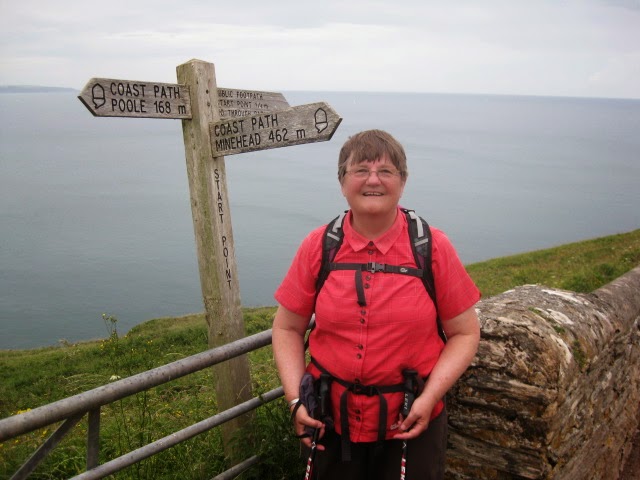 |
| At Start Point: only 168 miles to go! |
 |
| Toadflax |
A naturalist carrying out a butterfly count helped us to identify some of the butterflies that we had seen: gatekeepers (a new one for us), peacocks and the small tortoishell. In addition, among plants and flowers that we found were sea pea, black pea, everlasting pea, wild carrot, yarrow, ribbed melilot, speedwell toadflax and valerian. We also spotted the rare cirl bunting, a species which, with conservation measures which are being taken, is doing well in the area.
SWCP from Prawle Point to Start Point: 8.0km (5 miles);
Walk total: 15.8km (9.75 miles).
Cumulative distance from Minehead: 746km (463 miles);
Distance to South Haven Point: 268km (166 miles)
(Monday 07 July 2014)
Start Point to Beesands
Day four: a return linear walk from Start Point (car parking in the free car park at Beesands). This was a short walk when compared to the three previous days!
 |
| Start Point |
We set out from Beesands at about 10:00am after a leisurely start to the day, and headed south to Start Point: the 'wrong' 'clock-wise' direction on the path. At about 11:00am, having reached Hallsands, we paused for a welcome cup of coffee from our flask, seated on the conveniently-placed bench just above Greenstraight.
 |
| Hallsands |
Arriving at the Start Point car park, we enjoyed an Asian Style Pork Slider and tea, which we bought from the Surf and Turf refreshment van (£5.50). An excellent snack: we had the last one!
 |
| Surf and Turf refreshment van at Start Point |
Returning to Beesands after our refreshment stop, we followed the short detour to the Hallsands viewing platform with its panels explaining how - and why - the coastal erosion had taken place to cause the loss to the sea of the buildings.

We arrived back at the car at Beesands just as the heavens opened with a torrential downpour - just in time to avoid a drenching!
SWCP from Start Point to Beesands: 3.6km (2.25 miles);
Walk total: 7.3km (4.5 miles).
Walk total: 7.3km (4.5 miles).
Cumulative distance from Minehead: 750km (466 miles);
Distance to South Haven Point: 264km (164 miles)
(Tuesday 08 July 2014)
Beesands to Stoke Fleming
 |
| Beesands and Widdicombe Ley |
Day five: a linear walk from Beesands (car parking in the free car park at Beesands) to Stoke Fleming with a mile return section between Beesands and Torcross.
We set out from Beesands on this mostly easy-going walk at about 8:45am, firstly along the level path along the shingle bank between Widdicombe Ley and Bee Sands and then behind Beesands Quarry down to Torcross Point.
 |
| Sherman Tank War Operation Tiger memorial at Torcross |
 |
| Blackpool Sands |
The Path continues from Torcross parallel to the main road across Slapton Sands as far as Strete Gate, then on to Strete, Blackpool Sands and Stoke Fleming. Return to Beesands, firstly by bus from Stoke Fleming to Torcross and then walk back to Beesands.
 |
| Letterbox House, Stoke Fleming |
Butterflies spotted: comma, red admiral, peacock and large white; flowers and plants: tansy, viper's bugloss and foxglove.
SWCP from Beesands to Stoke Fleming: 10.7km (6.5 miles);
Walk total: 13.6km (8.5 miles).
Walk total: 13.6km (8.5 miles).
Cumulative distance from Minehead: 761km (472 miles);
Distance to South Haven Point: 253km (157 miles)
(Wednesday 09 July 2014)
Stoke Fleming to Dartmouth
This was another linear walk - from Stoke Fleming (free car park near to the church, in School Road) to Dartmouth - with the bus return from the Pontoon bus stop in Dartmouth to Stoke Fleming.
After parking the car in Stoke Fleming we repeated the short stretch of the official Coast Path along Rectory Lane and Ravensbourne Lane - alongside the recreation ground - to the lane to Redlap.
Above Compass Cove we made good use of a conveniently placed bench for our picnic lunch stop before continuing on our way to Dartmouth, passing Blackstone Point, Dartmouth Castle and Warfleet on the way with the Dart Estuary busy with boats.
We finished out picnic lunches on a bench among the Dartmouth crowds looking across the River Dart to Kingswear.
Our journey by bus back to Stoke Fleming was uneventful. It was, however, after leaving Stoke Fleming that events started to happen! On the way back to Meadow Barn Cottage we decided to stop at the Slapton Sands car park and were tempted to hot dogs and tea from the refreshment van there. We also visited the granite monument commemorating the ill-fated WWII 'Operation Tiger' in which 749 United States servicemen lost their lives in a disastrous rehearsal for the D-day landings.
Unbeknown to us, Vaughan dropped the key to the cottage in the car park; it was only when we reached Meadow Barn that we realised that the key was missing and at the same time Vaughan's eye began to haemorrhage once again.
There was nothing for it, but to return to the Slapton Sands car park in the hope that we would find the key: fortunately we did! After a meal, we quickly packed up and left the cottage a day early to head for the Dorchester County Hospital Accident and Emergency Department.
This time we lost just one day - and we had achieved what we had set out to do: namely walk the stretch of the South West Coast Path from Hope Cove to Dartmouth.
SWCP from Stoke Fleming to Dartmouth: 6.8km (4.25 miles);
Walk total: 8.25km (5 miles).
Cumulative distance from Minehead: 767km (477 miles);
Distance to South Haven Point: 246km (153 miles)
(Thursday 10 July 2014)
After parking the car in Stoke Fleming we repeated the short stretch of the official Coast Path along Rectory Lane and Ravensbourne Lane - alongside the recreation ground - to the lane to Redlap.
Above Compass Cove we made good use of a conveniently placed bench for our picnic lunch stop before continuing on our way to Dartmouth, passing Blackstone Point, Dartmouth Castle and Warfleet on the way with the Dart Estuary busy with boats.
 |
| Dartmouth and (right) Kingswear Castle |
We finished out picnic lunches on a bench among the Dartmouth crowds looking across the River Dart to Kingswear.
 |
| Kingswear from Dartmouth |
Our journey by bus back to Stoke Fleming was uneventful. It was, however, after leaving Stoke Fleming that events started to happen! On the way back to Meadow Barn Cottage we decided to stop at the Slapton Sands car park and were tempted to hot dogs and tea from the refreshment van there. We also visited the granite monument commemorating the ill-fated WWII 'Operation Tiger' in which 749 United States servicemen lost their lives in a disastrous rehearsal for the D-day landings.
Unbeknown to us, Vaughan dropped the key to the cottage in the car park; it was only when we reached Meadow Barn that we realised that the key was missing and at the same time Vaughan's eye began to haemorrhage once again.
There was nothing for it, but to return to the Slapton Sands car park in the hope that we would find the key: fortunately we did! After a meal, we quickly packed up and left the cottage a day early to head for the Dorchester County Hospital Accident and Emergency Department.
This time we lost just one day - and we had achieved what we had set out to do: namely walk the stretch of the South West Coast Path from Hope Cove to Dartmouth.
SWCP from Stoke Fleming to Dartmouth: 6.8km (4.25 miles);
Walk total: 8.25km (5 miles).
Cumulative distance from Minehead: 767km (477 miles);
Distance to South Haven Point: 246km (153 miles)
(Thursday 10 July 2014)


