The original aim was to walk the distance to St Just. Events happened to prevent this, but more of that in due course!
Our base for this section was The Treloyhan Manor Hotel in St Ives, a Christian Guild Hotel. The hotel provided comfortable, good value half board accommodation: excellent buffet breakfasts each morning and good evening meals.
 |
| St Ives |
Gwithian, Hell's Mouth to Hayle
We started this section on Sunday 15 September 2013 by catching the Western Greyhound service 547 bus from the Cornish Arms bus stop, near to the Treloyhan Manor Hotel to the Hell's Mouth Cafe, Gwithian. After coffee at the cafe, we set out on the way to Hayle, pausing to watch the 15 or so seals way below us on the beach at Fisherman's Cove - too far below us to make a worthwhile photograph.
We started this section on Sunday 15 September 2013 by catching the Western Greyhound service 547 bus from the Cornish Arms bus stop, near to the Treloyhan Manor Hotel to the Hell's Mouth Cafe, Gwithian. After coffee at the cafe, we set out on the way to Hayle, pausing to watch the 15 or so seals way below us on the beach at Fisherman's Cove - too far below us to make a worthwhile photograph.
The path then took us around Navax Point and Godrevy Point with the lighthouse on Godrevy Island.
 |
| At Godrevy Point |
Weather had started fine, but as we rounded Godrevy Point and headed towards Hayle the heavens opened! The rest of the way that day, as we negotiated our way across the dunes to Hayle, was a wet way.
When we finally arrived at Hayle we were glad to catch the Western Greyhound bus back to the Cornish Arms bus stop with a welcome bath back at the hotel. The day's walk was an easy eight miles with little in the way of ascent or descent.
Hayle to St Ives
The next stage was from Hayle to St Ives, which we did on a rather wet day.
We caught the bus from St Ives to Hayle to walk the return journey. We bought sandwiches for lunch and paused for a coffee before setting out - and then, dodging a rain shower, ducked into the Hayle Heritage Centre.
The Centre provides a fascinating insight to the history of the area and of the importance of the town in the earlier days of the Industrial Revolution.
From the Heritage Centre, The Coast Path passes underneath Brunel's railway Viaduct and then across The Causeway, along the northern side of the Hayle Estuary.
The Hayle Estuary is described by the RSPB on their web site as one of the best places for wildlife in the UK. Among the birds which we spotted on the estuary were swans, little egrets, oystercatcher, teal and greenshank.
On the way back to St Ives we visited St Uny Church, Lelant, overlooking The Towans on the opposite side of the estuary and then followed alongside the railway to Carbis Bay, where we ate our sandwiches sitting on the bench at the top of the flight of steps near to Carbis Bay Station.
Before returning to the hotel we paused again for refreshments at the cafe on the beach at Carbis Bay: an easy walk of about 5.5 miles.
St Ives to Zennor
We had already walked the section from Treloyhan Manor Hotel into St Ives, around St Ives Head, alternatively called 'The Island', as far as the Tate St Ives Gallery, on the Saturday that we arrived in St Ives. We thought that it would still 'count' if we did not repeat this section!
We started the day by a quick trip to the Tesco store for our picnic lunch for the day, before catching the bus the short distance from The Cornish Arms to the bus station in St Ives.
We set out through the town: up hill and down again, passing the Back-packers hostel on the way, eventually reaching the coast path just below the cemetery.

The South West Coast Path Guide describes this section as 'severe': so we were expecting it to be tough: 'It is tough going, with rocky scrambles and boggy lengths. But it can only be described as a magnificent length.' We agree: certainly it has its challenges, but the stunning views more than compensate. We were fortunate, too, that after a long dry period, we did not have to contend with very much in the way of boggy patches, despite the heavy showers on the way.
At Zennor Head we headed for the hamlet of Zennor, with its pub, the Tinners Arms and Backpackers Hostel.
We had plenty of time before the bus (a Western Greyhound bus service 508) to St Ives was due, so we paused for refreshment at the Inn. When we arrived at the bus station we, once again, rather 'cheated' and caught the bus up the hill to the hotel.
The day's walk was about 7.5 miles, 6 of which were on the Coast Path. Another thoroughly enjoyable, and - yes, challenging day.
Zennor to Morvah
It had been our intention to walk from Zennor to Pendeen, but events, referred to previously, put an end to this.
The day started absolutely fine: we returned to Tescos to buy our picnic lunch and then walked down to the bus station with plenty of time to catch the 09:35 Western Greyhound bus to Zennor, arriving there at just the right time to pause for a coffee at the Backpackers Hostel.
Refreshed, we set out on the way, heading the half mile or so back to the Coast Path, passing the church on the way.
All was going very well, passing by Gurnard's Head and Porthmeor Point followed by Porthmeor Cove. Once again the going was 'severe'. But that didn't daunt us!
It was fascinating and awe-inspiring to watch the gannets doing their aerobatics and diving for fish along this coastline.
We were doing well - with Pendeen Watch well within our sights for the day's walk. Then it all came to an end! Near Carn Veslan Cliff, a short distance after Porthmeor Cove, Vaughan, as usual stepping out ahead, stepped on what he thought was firm ground, which proved to be nothing more an a soft clump of grass. Over he went! And with a suddenly very painful ankle!
We carried gingerly on for a bit, until Vaughan decided, just by Morvah that he did not want to go on any further. We finally made it, with Vaughan hobbling on the uneven path to the shelter of the church. There we waited the hour for the bus back to St Ives.
That was all the walking for this trip; we returned home early, Vaughan resting his sore ankle!
The total day's walk was approximately 7 miles (South West Coast Path distance approximately 5 miles). The cumulative distance from Minehead was approximately 243 miles.
Hayle to St Ives
The next stage was from Hayle to St Ives, which we did on a rather wet day.
We caught the bus from St Ives to Hayle to walk the return journey. We bought sandwiches for lunch and paused for a coffee before setting out - and then, dodging a rain shower, ducked into the Hayle Heritage Centre.
The Centre provides a fascinating insight to the history of the area and of the importance of the town in the earlier days of the Industrial Revolution.
From the Heritage Centre, The Coast Path passes underneath Brunel's railway Viaduct and then across The Causeway, along the northern side of the Hayle Estuary.
The Hayle Estuary is described by the RSPB on their web site as one of the best places for wildlife in the UK. Among the birds which we spotted on the estuary were swans, little egrets, oystercatcher, teal and greenshank.
On the way back to St Ives we visited St Uny Church, Lelant, overlooking The Towans on the opposite side of the estuary and then followed alongside the railway to Carbis Bay, where we ate our sandwiches sitting on the bench at the top of the flight of steps near to Carbis Bay Station.
Before returning to the hotel we paused again for refreshments at the cafe on the beach at Carbis Bay: an easy walk of about 5.5 miles.
St Ives to Zennor
We had already walked the section from Treloyhan Manor Hotel into St Ives, around St Ives Head, alternatively called 'The Island', as far as the Tate St Ives Gallery, on the Saturday that we arrived in St Ives. We thought that it would still 'count' if we did not repeat this section!
We started the day by a quick trip to the Tesco store for our picnic lunch for the day, before catching the bus the short distance from The Cornish Arms to the bus station in St Ives.
We set out through the town: up hill and down again, passing the Back-packers hostel on the way, eventually reaching the coast path just below the cemetery.

The South West Coast Path Guide describes this section as 'severe': so we were expecting it to be tough: 'It is tough going, with rocky scrambles and boggy lengths. But it can only be described as a magnificent length.' We agree: certainly it has its challenges, but the stunning views more than compensate. We were fortunate, too, that after a long dry period, we did not have to contend with very much in the way of boggy patches, despite the heavy showers on the way.
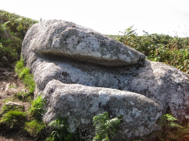 |
| A rock to clamber over..... |
We had plenty of time before the bus (a Western Greyhound bus service 508) to St Ives was due, so we paused for refreshment at the Inn. When we arrived at the bus station we, once again, rather 'cheated' and caught the bus up the hill to the hotel.
The day's walk was about 7.5 miles, 6 of which were on the Coast Path. Another thoroughly enjoyable, and - yes, challenging day.
Zennor to Morvah
It had been our intention to walk from Zennor to Pendeen, but events, referred to previously, put an end to this.
The day started absolutely fine: we returned to Tescos to buy our picnic lunch and then walked down to the bus station with plenty of time to catch the 09:35 Western Greyhound bus to Zennor, arriving there at just the right time to pause for a coffee at the Backpackers Hostel.
Refreshed, we set out on the way, heading the half mile or so back to the Coast Path, passing the church on the way.
 |
| Zennor Church |
It was fascinating and awe-inspiring to watch the gannets doing their aerobatics and diving for fish along this coastline.
 |
| Gurnard's Head |
 |
| The Path - not where he fell, though! |
We carried gingerly on for a bit, until Vaughan decided, just by Morvah that he did not want to go on any further. We finally made it, with Vaughan hobbling on the uneven path to the shelter of the church. There we waited the hour for the bus back to St Ives.
That was all the walking for this trip; we returned home early, Vaughan resting his sore ankle!
The total day's walk was approximately 7 miles (South West Coast Path distance approximately 5 miles). The cumulative distance from Minehead was approximately 243 miles.